Some pages of this website may contain advertising and cookies.
Some pages of this website may contain advertising and cookies.
=== by Bob Sutherland ===
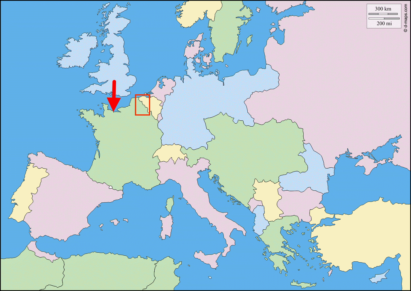
This is a map of Europe showing the political boundaries in 1914 at the start of the First World War. The red rectangle marks an area of France and Belgium where the Canadian soldiers spent most of World War I engaged in trench warfare fighting against the German army.
Despite all of the battles and lives lost the Western Front line separating the two armies did not fluctuate very far for about four years during the war. Each army dug a series of trench lines so they could retreat back one or two trench lines or advance forward and capture one of their enemy's trench lines in each battle. Often after losing a battle an army would immediately regroup. The officers would gather together their surviving soldiers and add some new soldiers, called "reserves", that were brought up from the rear. This reinforced army would then initiate a counterattack to win back any trenches and territory the army had lost in the previous battle.
The Western Front line was very long. Often while the British, French, Canadians or one of their allies may be winning a battle against the Germans at one location the German army may be winning a battle the same day at a different location a hundred or more kilometres away. A few days later both sides would be regrouping and trying to win back any territory they had recently lost in the battles.
Compared to some of the European countries the Canadian army was relatively small. During the First World War and the Second World War Newfoundland was an independent country with their own small army. Both the Canadian and Newfoundland armies spent most of the First World War within the red rectangle on the map.
The red arrow marks the location along the coastline in the Normandy region of France where the D-Day invasion of continental Europe began during World War II. The Canadians landed at a spot that was code named Juno Beach. On the east side of the Canadians the British landed at a spot that was code named Sword Beach. On the west side of the Canadians another British force landed at a spot that was code named Gold Beach. Farther to the west the Americans landed at two spots that were code named Omaha Beach and Utah Beach.
The Canadian military travelled around Europe and the world during the Second World War but I only have a few photographs of the troops and equipment landing at Juno Beach.
All of the photographs in this website's collection of Canadian war photos were taken at the two locations marked in red on the map.